**This post may contain affiliate links. If you make a purchase using the links in this article, I might earn a commission at no extra cost to you. Please see my full disclosure for further information.
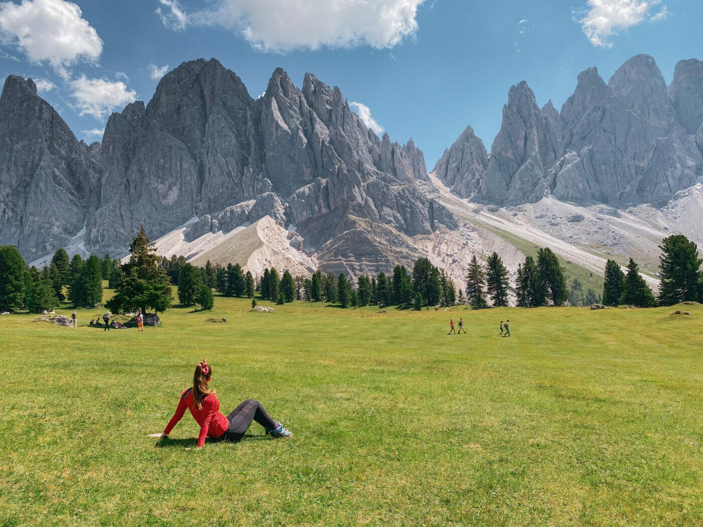
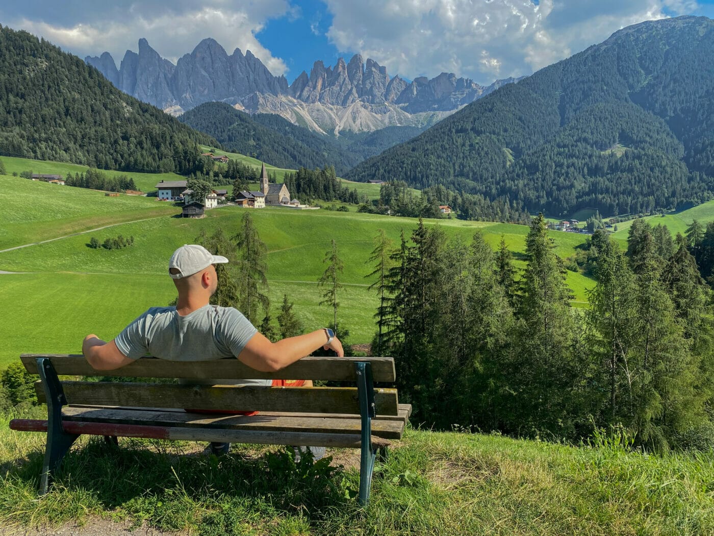
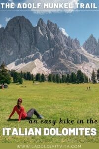
The Adolf Munkel Trail (Adolf Munkel Weg in German) is widely known as one of the most beautiful easy day-hikes in the Dolomites for its unparalleled views of the Odle/Geisler group mountains. It is seriously one of those viewpoints where the scenery legitimately looks photoshopped in!
Located in northeastern Italy in the Puez-Odle Nature Park, between Val Gardena (Grödnertal in German) and Val di Funes (Villnösstal in German), the Adolf Munkel trail skirts the northern side of the massive Geisler peaks.
Full of charming encounters, the hiking trail adventures through both woods and pastures all the while tracing along the imposing and barbed crests of the Odles. It’s a real mountain experience culminating at the Profanter family’s Gschnagenhardt Alm mountain hut.
At this hut you’ll get to experience some of the most impressive mountain views and try some top-notch Tyrolean cuisine all the while clapping along to traditional folklore music! Children love it as well getting a chance to see many farm animals along the way.
A family-friendly option and a couple’s favorite as well, this day hike is one of the most rewarding easy/moderate trails you can do in the Dolomites. Don’t miss it!
So, let’s get to the details!
Here below you’ll find all the information you need to know before embarking on the Adolf Munkel Trail. From trail directions to practical tips, this guide covers all the details!
Post Contents
Best time for hiking the Adolf Munkel Trail
So, for starters, when is the best time to hike the Adolf Munkel Trail?
As with most places in the Dolomites, Summer is the best season to hike the Adolf Munkel Trail. Crowds are obviously larger in the summer, but besides heading there early to guarantee parking, we didn’t find the crowd situation bothersome when we hiked it in late July.
To guarantee optimum trail conditions (no ice or frost) I would suggest sticking to the period from mid-June to mid-September. Any time outside of that and you can risk colder temperatures, closed mountain huts, hazardous trails (mud, snow, etc.) and/or erratic weather conditions.
If you want to risk it anyway and go in spring, note that until late May both Geisleralm and Gschnagenhardt Alm remain closed.
You can also go in the winter and opt for snowshoeing, but I’ve never personally done it so can’t speak for it. For more information on going in the winter, see section Adolf Munkel Trail with snowshoes.
How to get to the Adolf Munkel Trail
So, in order to get to the Adolf Munkel trailhead, you are going to head to the Zannes Parking Lot in Val di Funes. This is the parking lot of the mountain hut Malga Zannes (Zanser Alm in german). Input into your GPS “parcheggio Malga Zannes” and you will be led straight to this parking area.
To enter the parking area, you will have to pay a small fee at the booth depending on what time of day you’re arriving. Cars arriving in the morning pay more than those arriving in the afternoon (only staying a half-day). Campers pay a slightly higher fee at 12 euro.
Please arrive early! We got here at about 9.30 (that’s considered LATE!) and we got the last available parking space. If you’re hiking the Adolf Munkel Trail in peak months (July and August), make sure you arrive early (before 9a.m.) to avoid long queues for parking or having to delay the start of your hike.
Alternatively, you can arrive in the afternoon (there aren’t parking issues in the afternoon), but don’t underestimate the length of the hike – you don’t want to get stuck on the trails in the dark! Calculate at least 4 hours to complete it.
Getting to Adolf Munkel Trail by Bus
If you’re relying on transport to get around the Dolomites, there is the 330 bus that will take you directly to the Rifugio Zannes bus stop, a mere 50 meters from the start of the trail. Check this site for stops and updated times.
Adolf Munkel Trail: Step by Step Directions
Where to Park: Zannes Parking (paid) €
Hike Difficulty: Easy/Moderate
Trails: 6, 35 (Adolf Munkel Trail), & 36
Elevation Difference: 430 meters
Duration: At least half a day
When to go? Summer (mid-June to mid-September)
Mountain Huts: Rifugio delle Odle (Geisler Alm), Malga Casnago (Gschnagenhardt Alm), Dusler Alm
Suitable for Children? Yes
Suitable for Dogs? Yes, on a leash
Good Base Towns: Santa Maddalena, Bressanone, Ortisei
At last, we finally get into the details of the actual hike!
There are actually a variety of different paths you can take to get to the Adolf Munkel Trail and beautiful viewpoint at Gschnagenhardt Alm.
This post covers the easy/moderate 9.1km clockwise loop starting and ending in the Zannes parking lot following trails: 6, 35, and 36.
PLEASE NOTE: The hike discussed below only traces the more scenic section of the Adolf Munkel Trail. The actual trail in its entirety (Path 35) is longer going all the way to Malga Brogles (which this post doesn’t cover).
To make these instructions as clear as possible, I’ve divided the trail directions in sections that indicate the different trail numbers to follow. Use the map and trail summary below to accompany these instructions.
Map of Trail
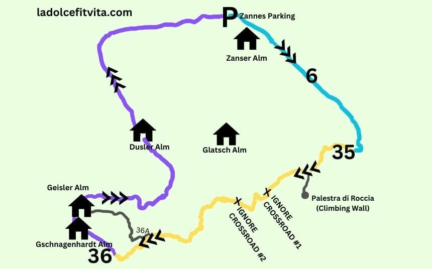
TRAIL SUMMARY DIRECTIONS:
- Zannes Parking to Trail 6 to Trail 35 (~ 40 min)
- Trail 35 to Trail 36 to Gschnagenhardt Alm (~ 1 hour)
- Gschnagenhardt Alm and Geisler Alm (rest, eat, take pictures!)
- Trail 36 to Dusler Alm to Zannes Parking (~ 1 hour)
See step-by-step instructions for each point below.
1. Zannes Parking to Trail 6 to Trail 35 (Adolf Munkel Trail Turnoff)
So, first thing’s first… getting on to the trail!
From the parking lot you are going to walk back to where you entered the parking area (see section above for parking instructions), and head towards the restaurant. From here, you’ll see several signs indicating different trail numbers. Proceed onto Trail 6 towards Geisler Alm or Tschantschenon – it’s the paved road on the right that also leads to Zanser Alm.
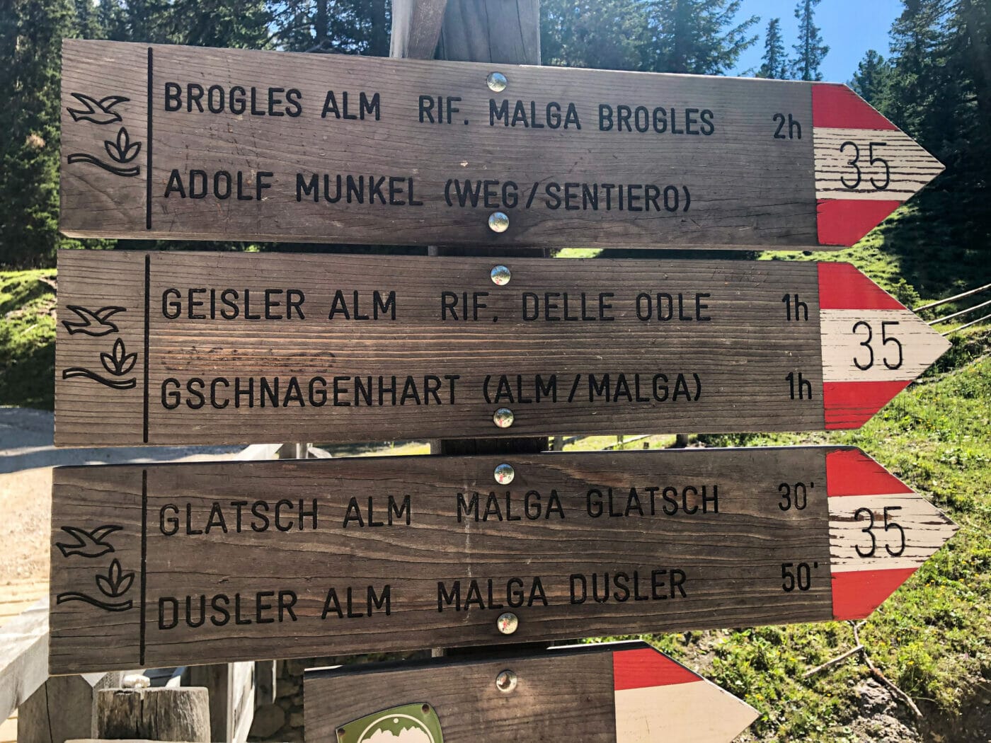
CLARIFYING NAMES! This hike can get confusing because the names on the trail signs are sometimes written in German and sometimes in Italian. Here are the main names to look out for while hiking:
Zans = Zannes
Gschnagenhardt Alm = Malga Casnago
Geisler Alm = Rifugio delle Odle
Dusler Alm = Malga Dusler
Adolf Munkel Trail = Adolf Munkel Weg/Munkelweg/Sentiero Adolf Munkel/Via delle Odle
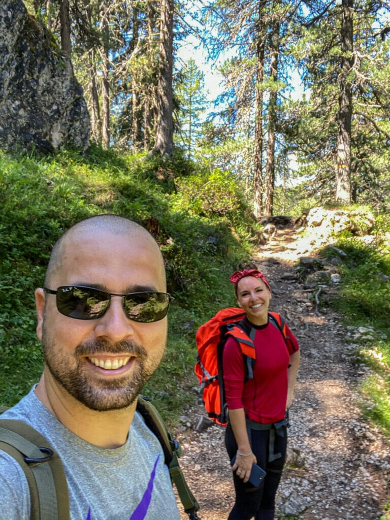
Trail 6 starts as an easy paved uphill road which quickly turns into a dirt path. Within minutes on the dirt path, you will pass Zanser Alm to your right.
Keep walking and you’ll soon see the path entering a stone pine forest. For the next 30 minutes or so, you will be hiking in the woods along the rio San Zenòn stream. Once you get to the little stone bridge and cross it, you’ll see the Adolf Munkel Trail turnoff (Trail 35) to your left.
2. Trail 35 to Trail 36 to Gschnagenhardt Alm
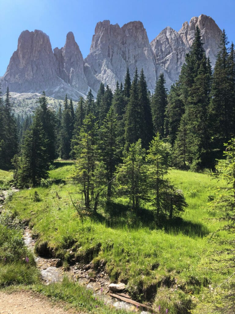
From the Adolf Munkel Trail turnoff, the path continues uphill inching closer to the foot of the Odle mountains. This is the most tiring part of the hike as the trail weaves up and down with some steeper sections.
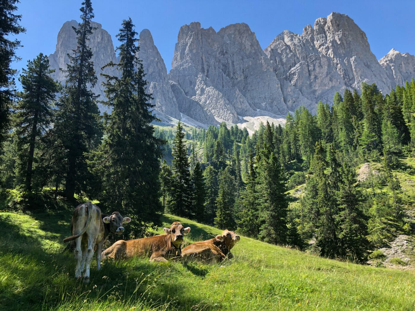
Most of the time you are still hiking through forested areas but as you draw closer to the summit, you start to catch more and more glimpses of the beautiful Geisler group.
As you continue on the Adolf Munkel weg (trail 35) for the next 40 minutes or so, you will encounter several forks in the road that at times can get confusing. The first major crossroads will indicate signs for Malga Glatsch. Disregard this turnoff and stay on Trail 35. Almost immediately after this, you’ll come to an almost identical crossroads again indicating a path towards Malga Glatsch. Again, disregard this and continue on path 35.
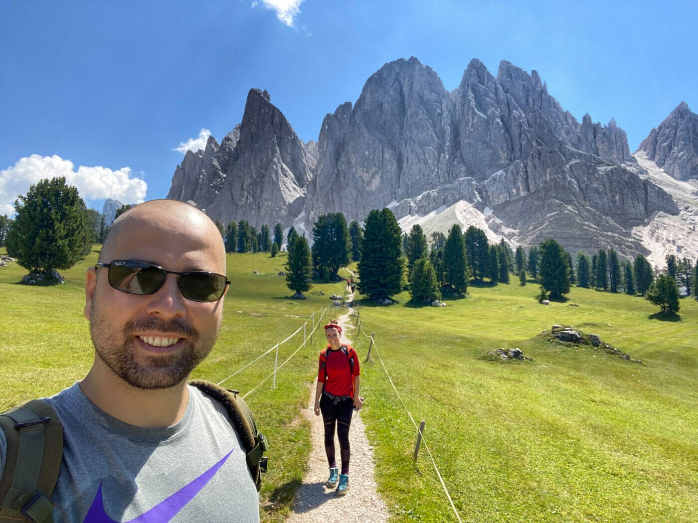
Finally, after about 40 minutes, you’ll reach yet another crossroads with one path leading towards Geisler Alm (Trail 36A) and the other path leading towards Gschnagenhardt Alm (continuation of trail 35 and then turn onto trail 36). Disregard path 36A and continue on towards Gschnagenhardt Alm. After about 10 minutes you’ll reach the last fork for path 36 – this is the last stretch to get to Gschnagenhardt Alm!
Make your way up the dirt steps and onto the beautiful meadow that unfolds at the top. You’ll see a mountain hut in the distance and a small gravel foot path leading to it…you’ve made it! That’s Gschnagenhardtalm!
NOTE: You can opt to take 36A if you are not interested in seeing Gschnagenhardt Alm and would like to go directly to Geisler Alm.
3. Gschnagenhardt Alm and Geisler Alm: The Dolomites Cinema!
So now that you’re here, walk towards Gschnagenhardt Alm and TURN AROUND! The breathtaking view is behind you!
The Breathtaking Views of the Odle Peaks
The unexpected and forceful scenery that unfolds at the top of the Adolf Munkel Trail is downright out of this world. I was quite honestly left speechless!
You will find yourself held captive in a fixed stare, marveling at the prominent peaks before you. From beautiful Furchetta, to Sass Rigais, to Nordwandtürme, to the Fermeda Peaks – each one is better than the next. The longer you hold your gaze, the closer the mountains will surreally appear to move in towards you – it’s quite the optical effect!
Seeing the Odle mountains so up-close in their proud and unwavering grandeur is truly extraordinary – don’t miss it!
The Mountain Huts
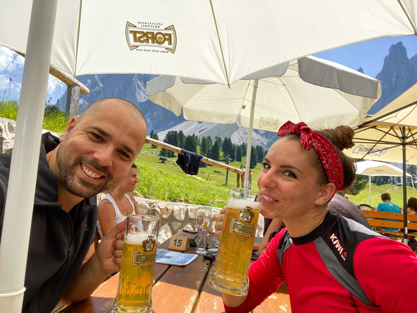
Once at the top, the first mountain hut you encounter is indeed Gschnagenhardt Alm or Malga Casnago in Italian. We decided to stop here to eat as we felt the views were better, the crowds smaller, and the overall vibe more authentic (less touristy) than Rifugio delle Odle (mountain hut you encounter after). But that’s just us!
I had some of the best canederli of the entire trip here (although I seem to only have a picture of our Radler beers lol) and the owner playing his accordion made for such a Tyrolean moment! We truly enjoyed our time here.
Before leaving and proceeding to check out Geisler Alm (a mere 5 minutes’ walk), we took a good hour or so to lie out in the surrounding pasture. This is a great place for a nice mountain nap and an even better place for photography.
Geisler Alm, a 5-minute walk down path 36, is the second mountain hut you encounter and is actually the more notorious mountain hut of the two. Also known as Rifugio delle Odle, Geisler Alm is renowned for its Cinema delle Odle (Odle cinema). A sort of open-air theater, you’ll find lounge chairs lined up much like armchairs in a movie theater. The only thing different is that instead of a film-picture on screen, the ensuing scenery is the movie, and the mountains themselves the actors.
Having spent over an hour at Gschnagenhardt Alm, we didn’t spend much time here. We can’t speak for the food, but we did notice the fantastic playing area for small kids. Children here will have a chance to interact with goats, rabbits and donkeys – they’ll love it here!
4. Trail 36 to Dusler Alm to Zannes Parking
Once you feel rested and are good to go, you can start to head back down to the parking lot. From Geisleralm follow trail 36 towards Dusler Alm or Zans/Zannes. The entire walk down takes about an hour. At about 40 minutes into the walk, you’ll get to Malga Dusler where you can stop for a snack or bathroom break and then continue to proceed all the way back down.
Once you get down to the parking, walk across the parking lot to get to your car. Congratulations… you’ve completed the hike!
Adolf Munkel Add-on (Optional)
Santa Maddalena Church and Panorama Trail
When in the Val di Funes, most people like to add-on the famous and easy Santa Magdalena Viewpoint/Lookout walk. It’s a very gradual uphill walk that leads to a panorama point that takes about 30 minutes to get to. **Make sure you park your car where it is allowed! No driving or parking is allowed on the road that leads to the Church and viewpoint.**
**TIP! You need a superzoom lens to get a good photo! We didn’t have one and as you can see below, our zoomed photos are not ideal.
IS IT WORTH IT? I have personally done this short walk, but if you’re pressed for time, I would honestly leave it out. In my opinion, there are plenty of other hikes and viewpoints in the South Tyrol that are more worthwhile.
What to bring on the Adolf Munkel Trail?
As with most day-hikes in the Dolomites, always make sure to have good hiking shoes and warm clothes and rainwear in your backpack just in case. For more information on what to pack see my full packing guide here.
Here are a couple items needed specifically for this hike:
- Cash – the parking lot only accepts cash, and sometimes mountain huts have issues with their card readers. Make sure you bring cash!
- Map (Brand: Tabacco) – if you’ve read my guide on planning a trip to the dolomites, you’ll know that reliable maps (that don’t rely on internet service) are a must when hiking in the mountains. Maps by Tabacco are the best ones to have. The Tabacco Map number 030 covers the entire Val di Funes hiking area.
Where to stay near the Adolf Munkel Trail?
Where you stay near the Adolf Munkel trail really depends on how much hiking you are planning on doing in Val di Funes.
If you are planning on doing several excursions in the Val di Funes area, then getting an accommodation close to the trail makes sense. If you are just passing through specifically for this hike, it might be a better idea staying in an accommodation that is more central to the other hikes of your interest and just making the drive for the day.
Down below I’ve listed a few top choices based on their budget and vicinity to the trail. I haven’t stayed personally in these but I meticulously research all of them, only recommending those that we would personally book for ourselves as well. (When we hiked Adolf Munkel, we were staying rather far in Rasun (1+hr drive away) in a simple and budget-friendly apartment.
Luxury – Forestis Dolomites
Bressanone (Brixen), 40 min from trailhead
Discover modern alpine architecture and indulge in first-class wellness at this adult-only resort. From gourmet food to stellar views, turn your hiking holiday into a 5-star spa retreat at Forestis Dolomites.
Mid-range/High-range – Villa Messner
St. Peter – Funes, 15 min from trailhead
After a hard day of hiking, get your own private sauna experience or relax at this villa’s beautiful outdoor pool. And in the morning, enjoy those gorgeous mountain views as you feast on a fabulous continental breakfast.
Low/Mid-range – Panoramic Residence Schopplhof
Villnöss, 20 min from trailhead
Enjoy a quiet and intimate getaway at this charming alpine apartment. Complete with mountain-view balconies or garden access, when it comes to views, this is an accommodation that will not disappoint.
Adolf Munkel Trail FAQs
Any last minute questions? Here are the answers to some of the most common questions regarding the Adolf Munkel Trail:
Is the Adolf Munkel trail stroller-friendly?
No. Although the Adolf Munkel trail is a great option for families, the trail is not suitable for strollers. If you’ve read above, you’ll have seen that the trail at times presents very uneven terrain. Having said that, it’s nothing you can’t get around if you purchase a baby carrier.
Can the Adolf Munkel trail be done in Winter with snow shoes?
I haven’t been in this area in the winter, but I know IT IS POSSIBLE to hike up to Geisleralm in the winter with snowshoes! The trail suggested however is different so double check with Geisleralm for recommendations on the best trails. (Note that Gschnagenhardt Alm remains closed in the Winter).
I’ve read that Geisleralm even offers toboggans for rent for the return journey (needs to be booked 24 hours ahead)! They even offer full-moon tobogganing if you’re interested in a night activity!
*For more information and for trail conditions always double check with them before heading out.*
Are dogs allowed on the trail?
Yes. Dogs are allowed on the trail, but they must always be kept on a leash. The hike is safe/suitable for dogs as it doesn’t present any particular difficulty.
Can I fly my drone on this hike?
No! The Dolomites are a protected UNESCO World Heritage Site and as such, prohibits drones. Unless you have a special permit or specific permission do not fly your drone – you may be heftily fined, and your device confiscated.
So, there it is guys… my complete guide to hiking the Adolf Munkel Trail. With unmatched views of the Odle peaks and gorgeous alpine pastures, this hike really makes for a postcard moment you do not want miss when in the Dolomites!
If you have any other questions or want to add suggestions/tips, please feel free to contact me or comment below – I love helping and receiving your feedback!
Don’t forget to follow along on my adventures at @ladolcefitvita…
Buona Passeggiata! Happy Trailing!
Here are some other Dolomites travel guides you might find helpful:
- Gran Cir – A Via Ferrata for Novice Climbers
- Spectacular Bike Trail Crossing the Italian-Austrian Border (suitable for kids!)
- Alpe di Siusi – Exploring Europe’s Largest Alpine Meadow
- Lago di Carezza: An Easy Walk for Families around this Stunning Lake
- Discover Lago di Braies – The Pearl of the Dolomites Emerald Lake
- Explore Peaceful Lago di Dobbiaco – A Hidden Gem in Val Pusteria
Pin Me for Later!
This blog post is intended for general informational and educational purposes only. Please read my full disclosure for further information.
Leave a Reply